Sea Level Rise Flooding at Superfund Sites Poses A Threat To Coastal Communities

Sea level rise flooding poses a multi-dimensional threat to coastal communities. Residential and commercial real estate, the economy, mortgage and insurance markets, tax bases and critical infrastructure are all at risk from rising waters. As if this list isn’t enough, the Union of Concerned Scientists — a non-profit organization that advocates the use of science to address pressing problems — recently released a report that points out that flooding at Superfund sites could spread dangerous chemicals in coastal communities threatening lives and property.

The researchers warn that there are about 2,000 Superfund sites contaminated by extremely hazardous chemicals located within 25 miles of the East or Gulf Coasts. They say in their report titled “A Toxic Relationship” that rising seas could flood many of the polluted sites which could lead to people in surrounding communities coming into contact with the health-threatening chemicals. The scientists note that the areas around the Superfund sites are “disproportionately populated by communities of color and low-income communities” and they are calling on the government to take steps to protect them.

“Decisionmakers must take action now to protect the health and safety of the communities located near these facilities,” the report says. Among their recommendations is that the government agencies work together to evaluate the risk climate change and sea level rise pose to Superfund sites. Officials should use the information gathered to draw up plans to prepare communities for the risk and improve the resiliency of Superfund sites faced with potential inundation by floodwaters.

Real estate buyers and owners in coastal communities should consider the proximity of their property of interest to Superfund sites and other facilities — such as ports, power plants and factories — when evaluating the risk of sea level rise flooding. If nothing is done to identify and address the threat, lives and property could be harmed.

Flood Factor, a Revolutionary New Service, Aims to Help Real Estate Buyers, Owners & Real Agents Evaluate a Specific Property’s Flood Risk

Wouldn’t it be cool if real estate buyers were able to tell if a property of interest was currently at risk of flooding — or, due to sea level rise, might flood in the years to come — with a few taps on their smartphone screen?

Of course! This type of app would level the playing field between buyers, who don’t know the current and future flooding risk, and sellers who do — or should. As we’ve discussed before in posts and videos, it isn’t always easy for a buyer to tell if a property floods or is at risk of flooding.

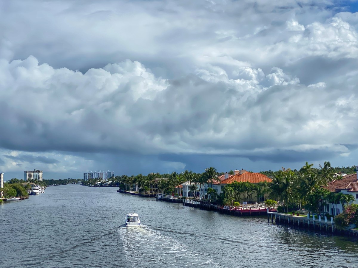
In some instances, sea level rise-related flooding occurs during the so-called “king tide” season in the fall, when the alignment and proximity of the sun and moon to earth create extra high tides. Buyers who visit a property during other times of year likely won’t see evidence of flooding.

Another challenge is that state seller disclosure laws range from Virginia’s wide-open “let the buyer beware” approach to Louisiana’s pretty stringent “tell them everything you know”-style law. Most states fall somewhere between the extremes, and buyers can easily fall through the cracks. The situation is so dire there are many documented cases where buyers didn’t know a property regularly flooded until the water showed up at their doors.

Further compounding the situation, is a privacy law passed in the 1970s that requires seller permission for the release of a property’s flood insurance claims history. Many buyers don’t bother to request the information.

So back to the app idea. I’ve sampled a few smartphone apps that are basically toys. They show you virtual reality-style what different levels of flooding would look like on a given property, but they don’t seem to rely much on actual data regarding a specific property’s elevation, flooding history, and other factors that would help buyers to weigh the real-world risk of flooding.

The best resource I’ve tried — not yet in app form but available on a webpage — is Flood Factor. The free service was developed by researchers at First Street Foundation, a non-profit research and technology group committed to defining America’s flood risk.

The Flood Factor interface is as easy as it gets. Users enter an address into a simple field and, if all goes well, they receive a detailed report regarding the flood risk for a given property. What really makes this a standout is the fact that the data is delivered in an easy-to-understand format. You get a clear understanding of the current flood risk on a 1-to-10 scale AND the risk for the next thirty years, which is the average lifespan of the most common mortgage. First Street’s researchers even figure sea level rise into their forecasts.

Coastal and inland buyers can benefit from Flood Factor, too. The researchers not only estimated coastal flooding risk, they also evaluated the risk of flooding due to strong storm surge, rivers overtopping their banks, and heavy rainfall events.

Flood Factor’s researchers combined many data sets to generate the detailed flood risk reports for specific properties. They say that their data is much more rigorous than that used by the Federal Emergency Management Agency, which administers the National Flood Insurance Program. FEMA’s flood maps are notoriously outdated and inaccurate, so relying on them alone for real estate decisions is, in itself, risky.

The only problem I had with Flood Factor was that when I entered certain addresses located in areas known to flood in my town, the program said there was no data available. When I clicked on a link that said it would give me more information, I ended up back at the address input screen.

Despite this shortcoming — and I have no idea why it happened or the extent of the problem — Flood Factor is definitely a service that real estate buyers should use. It’s also of value to sellers, who might not know the full extent of the flood risk to their properties, and real estate agents, who need to know their farm areas to deliver top-notch service.

One final important note, despite Flood Factor’s comprehensive approach to flood forecasting, buyers shouldn’t rely solely on the reports when making real estate decisions. For example, if a property is at risk of flooding, buyers should find out what, if anything, is being done to mitigate the risk. An effective mitigation project — such as a sea wall — might reduce the risk for the period the buyer intends to enjoy the property. Buyers should also consider how flooding on the property of interest or in the greater community might impact their maintenance costs and tax and insurance rates. In short, taking the time to understand the big picture might prevent costly mistakes.

While not technically an app, Flood Factor can easily be accessed and used on a smartphone. Give it a spin.

New Report: Millions of U.S. Property Owners Are Unaware Their Properties Are At Risk of Flooding

As many as six million U.S. properties face a substantial risk of flooding without their owners being aware of the threat. That’s according to a report recently released by the First Street Foundation, a non-profit research and technology group committed to defining America’s flood risk.

The researchers combined data from a number of different sources to develop a model that determined 1.7 times more properties face a substantial risk of flooding than are awarded that designation by the Federal Emergency Management Agency (FEMA), which administers the Federal Flood Insurance Program.

In real numbers, 14.6 million properties are at substantial risk of flooding. However, due to the well-known shortcomings of FEMA’s chronically outdated and/or incomplete flooding maps, the report says the owners of 5.9 million properties are “currently unaware or underestimating the risk they face because they are not being identified as being within the FEMA designated SFHA (Special Flood Hazard Area) zone.” Interestingly enough, the researchers also found that some areas that are listed by FEMA as being in SFHAs actually shouldn’t be.

The danger to real estate owners in all of this is that millions of property owners who should buy flood insurance might not have it because they’re not aware of the risk. Others who have it, might be paying for coverage they don’t actually need. Among the problems for homes that flood is they can be expensive to repair, experience a loss in value, and can be hard to sell. They can also flood again and again, compounding the owner’s misery.

When creating the report, the researchers considered many potential sources of flooding, including rivers, rainfall, storm surge and tidal source. To estimate the future risk of flooding, they also took climate change-generated extreme weather and sea level rise into account. First Street estimated that 21.8 million properties are at risk of flooding this year. Climate change will boost that number by 1.7 million properties over the next 30 years.

First Street created the report to help real estate buyers and sellers to make informed decisions regarding properties at risk of flooding. This is especially important for buyers since states vary widely regarding the amount of information sellers have to disclose to them and the flood insurance history of a property is protected by privacy laws.

In addition to the groundbreaking flood report, First Street has created a tool called Flood Factor that real estate buyers and owners can use to determine the current and future risk of flooding to a particular property by entering the address. When put to the test, Flood Factor provided reports for some addresses but not all addresses, including those that are located in well-known flood prone areas. A screen would appear that said “Information for (X Address) is unavailable. Please try another location or find out why this address isn’t listed.” When we clicked to find out why an address wasn’t listed we were taken back to the address search screen.

When First Street works out the kinks, Flood Factor will be a very useful resource to all real estate owners and buyers. Knowing the risk of flooding with a few key strokes will even the playing field in real estate transactions in a way that’s now not always possible. The researchers also hope that the information will be used by mortgage providers and insurers to better assess risk and by government planners to decide how to better address flooding.

15 U.S. Communities Set High Tide Flooding Records Due To Sea Level Rise

“Sea level rise flooding of U.S. coastlines is happening now, and it is becoming more frequent each year.” That warning is the opening sentence of a new U.S. National Oceanic and Atmospheric Administration report titled “2019 State of U.S. High Tide Flooding with a 2020 Outlook”.

Agency scientists report that in 2019 fifteen communities, including Miami, Charleston, and Savannah, set records for the number of days that they experienced so-called “sunny day” flooding that isn’t related to rain storms or storm surge. From May through April, East Point, a city near Houston, TX, reported 64 days of high-tide flooding.

According to the report, the situation is going to get much, much worse as sea levels continue to rise in the coming decades. In some cases, it will reach the point that the high tides now bringing “nuisance” flooding will one day be considered the normal high tide.

It’s important to note that NOAA only measures high-tide flooding at 89 sites, so there may be many more communities experiencing regular sea level rise flooding on an increasing basis that aren’t included in the agency’s findings. The experts list New York City, Philadelphia, Baltimore and Washington among the communities that could see 100 days a year of high-tide flooding by 2050.

Of special interest to real estate owners, the report mentions that the bouts of sea level rise-driven flooding are already “damaging to infrastructure and cause other economic impacts (transportation delays, businesses closed, tourism impacts, etc.) in coastal communities”. As we’ve seen, coastal cities and towns are already scrambling to find hundreds of billions of dollars to pay for projects — such as sea walls, pumps and the raising of roads and water and sewer pipes — to deal with sea level rise flooding. With federal funds hard to come by, the burden of paying for the much-needed projects will likely fall on taxpayers. Owners and buyers need to stay informed about this pressing problem to protect their financial futures.

The Siberian Town that Broke 100 Degrees & You

On Saturday, June 20, the Siberian town of Verkhoyansk located above the Arctic Circle hit a scorching, all-time record high of 100.4 degrees. What’s that have to do with those of us who live thousands of miles away in the U.S.? As residents of the same planet, a lot.

First, the record is a sure sign that the simple science behind climate change, read global warming, is on the mark. It goes like this: We burn fossil fuels (think oil, gasoline, coal), greenhouse gases — most notably carbon dioxide — accumulate in the atmosphere, the greenhouse gases trap radiation from the sun in the atmosphere, and the atmosphere, ocean and land heat up.

Second, the heating of northern climes isn’t just a matter of extreme summer weather. Under the spell of the sun that never sets this time of year up there, the land surface heats up and permafrost begins to melt. As it melts, methane, a more potent but not as long-lasting greenhouse gas is released into the atmosphere, leading to even more warming. The feedback cycle generates more and more melt and more and more methane release.

We’re not done with second point yet. The heating of the northern climes also leads to the normally damp land drying out, which results in forest fires. The fires pose at least two threats: They release more carbon dioxide into the atmosphere — accelerating global warming — and the soot can settle on snow and ice fields. There, the dark soot absorbs solar radiation which result in faster melting. The water pours into the ocean contributing to sea level rise. Scientists witnessed this dynamic when wildfires in Canada coated Greenland’s ice sheet in soot and melting occurred at a faster rate.

Third, the global warming-driven record high temperatures in Siberia, Alaska, Greenland and other high latitude locations can alter weather patterns. Specifically, they can cause a buildup of high pressure areas that stall the jet stream, which normally keeps weather systems moving from west to east. When they stall, they, too, can heat up. This is contributing to the seemingly never-ending series of monthly high temperature records being set around the globe.

So, what’s all this have to do with you (us)? Record heat above the Arctic Circle is clearly a warning sign that the climate is changing more rapidly than many scientists anticipated. We have pumped more carbon into the atmosphere than has been recorded in millions of years. As a result, there is the very real risk that high temperatures now considered unusual will soon become the norm while extreme high temperatures become, well, more extreme. This cycle could accelerate to the point where, quite frankly, parts of the planet could become inhospitable to human life.

The reality of rapid global warming already poses a threat to millions of people who live in coastal areas. Many of us reside in cities and towns that are already experiencing sea level rise flooding or will likely experience it in the coming years. If the planet warms faster than expected, it’s likely that the rapid melt Greenland experienced due to extremely high temperatures last summer will become the norm. The warming could also cause the Arctic ice sheet, the other major contributor to higher seas, to become further destabilized as floating ice sheets that hold back inland glaciers break off the continent. If enough sea ice vanishes, inland glaciers could become uncorked and rush from land into the sea. The combination of melt in Greenland and a river of Arctic glaciers spilling into the ocean could lead to seas rising much faster than predicted when many locations are already struggling with the foot or so of sea level rise that’s been recorded in the last hundred or so years.

The bottom line for you (us) is global warming is fact. The heating we’re now witnessing and its consequences was anticipated decades ago by the majority of climate scientists. The only real X-factors are how much fossil fuels we’ll burn in the years to come and exactly how fast they’ll warm the atmosphere, ocean and land.

So where does this leave you (us)? Science says the only way to stop the dangerous global warming feedback loop is for humans to burn less fossil fuels. It’s that simple. To achieve this objective, we need to elect leaders who are dedicated to the cause and give our business to companies that help us to trade fossil fuels for environmentally-friendly energy sources.

If we fail to cut back on releasing carbon into the atmosphere, the tiny town in Siberia will prove to be the canary in the coal mine none of the miners listened to.

US Real Estate Mortgage Market Already Defending Itself Against Sea Level Rise

While many coastal communities struggle to control sea level rise flooding, US real estate mortgage providers are already taking steps to protect their businesses against the risk of inundation.

According to a New York Times article titled “Rising Seas Threaten an American Institution: The 30-year Mortgage”, banks in coastal areas are requiring buyers to make higher down payments as a hedge against the risk that sea level rise flooding and the loss of property value will encourage buyers to default on loans. In some cases, banks are requiring buyers to pay up to 40% up-front compared with the traditional 20% down payment.

The banks are also increasingly selling the mortgages to government-backed buyers to get the risk off their books. Interestingly enough, the article notes that small, local banks that know where flooding is now occurring or likely to occur soon are selling off loans the fastest. Unfortunately, if any of the sold loans fail, taxpayers will have to cover the loss.

Experts quoted in the article worry that sea level rise is making it difficult for buyers to get mortgages in coastal areas at risk of sea level rise flooding and storm surges from storms that grow more powerful as the planet heats up, which could cause values to drop. A representative for the Mortgage Bankers Association said flood insurance is protecting property in at-risk areas which should help prevent a mortgage meltdown. (Apparently, he isn’t aware that FEMA’s flood insurance maps are horribly outdated and don’t consider sea level rise flooding.) The fact that properties have to be insured against flood loss, however, hasn’t completely alleviated the experts’ concern. One researcher told the New York Times that flood insurance won’t help in cases where flooding causes a property to lose all value and can’t be sold.

Activity in the financial sector, including mortgage providers and insurers, is usually forward looking . Their growing concern over the impact sea level rise flooding will have on the mortgage, insurance and, ultimately, coastal real estate markets should act as a wake-up call that spurs buyers, owners and real estate agents to start paying close attention to this growing risk.

Virginia Beach Restricts Real Estate Development in Bold Sea Level Rise Plan

The city council in Virginia Beach, Virginia, voted this week in favor of a bold new plan to combat sea level rise and intense storm flooding. The city, which is in an area that already experiences climate change-driven flooding, requires developers to take more stringent steps to plan for flooding from sea level rise and strong storms.

Under the new plan, the city is calling on developers to design projects that handle 20 percent more rainfall than the National Oceanic and Atmospheric Administration predicts for the region. As the earth’s atmosphere continues to warm, climate experts predict more storms with downpours capable of flooding. The city is also requiring developers to replace the methods they’re now using to predict where stormwater runoff will go with more accurate Environmental Protection Agency software.

The city’s plan also includes provisions that require new construction projects to accommodate flooding due to sea level rise predicted between now and 2085. Hospitals and other critical infrastructure will have to be built to handle 3 feet of sea level rise. Non-critical structures will have to cope with 1.5 feet of higher seas.

Acting City Manager Tom Leahy told The Virginia-Pilot that replacing old regulations with the new plan now will save the city money tomorrow. “The more we develop under the old standards, the more we’re going to have to fix down the road,” he said.

Virginia Beach’s investment in these regulations and other steps to combat flooding from sea level rise, storm surges and rainstorms is expected to save millions of dollars each year. The city says some federal funding will be needed to cover the cost of the new projects.

Virginia Beach’s pro-active approach to climate change related flooding is commendable. Many major coastal cities are allowing expensive development with little thought to the impending threat and the cost to future generations.

This brings up an important point for real estate buyers: Just because a coastal community allows development doesn’t meant it is immune to flooding. Always perform due diligence to find out if a property of interest experiences flooding or is likely to experience flooding during the period you intend to own it. Also consider the fact that flooding can result in higher carrying costs for maintenance, taxes and insurance and it may cause the property value to decline.

Can We Rely on Mangroves to Provide a Line of Defense against Sea Level Rise Flooding?

One of the greatest challenges involved in combatting sea level rise flooding is finding solutions that will stand the test of time. Some coastal communities have been seeking natural solutions, such as sand dunes, wetlands and native vegetation, to hold back ever-higher tides and storm surges. Planners recognize the ability of natural ecosystems to self-regulate and adjust to sea water as it exerts pressure to march inland.

In the U.S., some southern Atlantic and Gulf Coast communities have been including mangroves in their action plans. They’re counting on the thick, leafy forests that thrive in shallow coastal waters to not only absorb and store some of the carbon released into the atmosphere by the burning of fossil fuels that’s driving global warming but to act as a buffer against storm surges and higher tides. They also hope to benefit from the mangroves ability to capture sediments and build land when the seas are trying to erode it away.

The idea sounded great until a recent study led by Macquarie University in Australia found that unless humans reduce the release of greenhouse gases, the seas will soon rise at a faster pace than the mangroves can accommodate. With sea level rise accelerating, due to ocean expansion and the ever-quickening pace of ice melt in Greenland and Antarctica, the mangroves could start to disappear within the next thirty years.

Unfortunately, real estate alone won’t pay the price when mangroves are gone. Mangroves provide a valuable nursery for birds, fish and other organisms. Their loss will endanger whole ecosystems.

More Powerful Storm Surges and Sea Level Rise Flooding Force Charleston, SC, to Ponder Its Future

Charleston, South Carolina, a densely developed peninsula surrounded by creeks and rivers that pour into the ocean, has reached the point where sea level rise flooding and the threat of ever more powerful storm surges threatens its very existence. The title of a recent article in The Post and Courier sums up the situation quite succinctly: “Charleston faces an existential choice: Wall off the rising ocean or retreat to higher ground.”

As the city celebrates its 350th year, the Army Corps of Engineers released a proposed plan to see it through 50 more. The Corps is calling for the construction of an 8-mile protective wall around the core peninsula along with pumps to help keep the city dry. Additional infrastructure improvements, such as raising flood-prone roads and clearing spaces to store water after heavy rains, may also be needed. The project would cost an estimated $1.75 billion with locals responsible for $600 million of the tab.

As with many other cities considering massive projects to protect valuable coastal real estate from inundation, funding for the proposed project is a major sticking point that has only been made worse by the budget-busting coronavirus pandemic.

Some residents see Charleston’s historic value and ability to draw 7 million tourists a year as reason alone to mount an aggressive effort to save it. They’re concerned that if they don’t get started soon, flooding will diminish the city’s value.

On the other hand, The Post and Courier article by Chloe Johnson hints that some residents exhausted from past floods are considering moving out. And at least one academic worries that the wall will give people a false sense of security that might result in increased investment in the peninsula. Andy Keeler, a climate expert at Eastern Carolina University, told the paper that this can result in a more painful economic collapse when sea level rise and storm surges eventually defeat the man-made defenses.

The Army Corps of Engineers estimates that without the wall and other improvements, Charleston will lose half of its historic structures to flooding by 2075. Real estate buyers and owners in Charleston and other coastal cities and towns confronting similar challenges need to consider the costs and benefits of proposals to rein in the water — and the potential that projects will never be built — when deciding how to react to the growing threat of sea level rise flooding and more powerful storm surges.

Coastal Real Estate Buyers, Owners & Agents Need to Start Paying Attention to Storm Surge Prevention Projects

A major impact of global warming is stronger storms with more powerful storm surges. Climate change-driven sea level rise will also further magnify the ability of storm surges to inundate valuable real estate.

Cities along the U.S. coast are shifting from considering the threats stronger storm surges pose to local real estate to actually proposing solutions. Real estate buyers and owners need to pay close attention to what’s appearing on the drawing boards. The surge control projects could impact their property values, businesses, tax rates and quality of life.

Real estate agents need to stay current so they’re armed with facts when buyers, sellers and owners ask for the latest information about projects in their farm areas.

In Florida’s Miami-Dade County, ground zero for sea level rise flooding, for example, the U.S. Army Corps of Engineers recently unveiled a draft plan that would spend $4.6 billion on a series of 1-to-13 foot tall sea walls and pumps to protect 2.8 million people and tens of thousands of buildings worth $311 billion from storm surges. According to a Miami Herald article, the project also calls for moveable barriers to be installed at the mouths of three waterways and the elevation of thousands of buildings.

The Corps of Engineers is holding online public hearings regarding storm surge the plan this week. The impact on some property owners could be enormous. For example, a thirteen foot wall and pump stations would certainly change the view from front-line properties. The loss of a beautiful view would impact the quality of life for the owners as well as property values.

In addition, current estimates are that local taxpayers would have to bear up to 35% of the project cost while the federal government would pick up the remainder. Depending on how the project financing is structured, property owners could face substantial tax hikes. (After Covid-19 rocked the economy and government budgets, funding is bound to be a big X-factor even for projects that receive a stamp of approval.)

According to an article on the YaleEnvironment360 website, ambitious storm surge control projects are also being considered in Charleston, SC, Galveston, TX, coastal communities in New Jersey, and in and around New York City. Real estate buyers and owners in coastal areas need to keep up on the latest developments to weigh the benefits and costs of the the proposed projects. Put another way, they need to ask if the projects will protect their property, property value and quality of life without emptying their wallets.

It’s important to note that the storm surge project in Miami-Dade isn’t intended to protect communities from the increased tidal flooding that will occur as sea levels continue to rise in the decades to come. That will take a whole other effort, if it’s possible at all. This is due to the fact that South Florida is built on porous limestone, which allows seawater to easily flow beneath structures such as seawalls. Things are, indeed, getting complicated for coast-dwellers.