Norfolk, VA, Group Hosts Contests to Develop Sea Level Rise Mitigation Programs

As cities and towns along the U.S. coastline scramble to address sea level rise flooding, a non-profit, economic development group in Norfolk, VA, is hosting contests to encourage the private sector to develop ideas.

Norfolk is experiencing some of the fastest sea level rise in the country, and it’s desperate for solutions. The city is using a share of a $120 million grant the State of Virginia received from the federal government to improve its resiliency to flooding.

Among the programs the city supports is an economic incubator called RISE, which is giving seed money to six small businesses that won a contest by submitting innovative proposals to address sea level rise and climate change. The ideas include teaching local business contractors how to elevate houses and establishing oyster reefs to protect the shoreline from storm surge.

This year’s RISE Coastal Community Resilience Challenge includes an invitation for company’s to submit proposals to develop an app that will give drivers real-time flooding information. The group is also looking for proposals to deal with stormwater in parking lots, detect sudden intense rainstorms, and beach sand replenishment.

For more information visit RiseResilience.org.

Are Miami Area Real Estate Owners Ready for 13-Foot Tall Walls to Control Storm Surge?

How do you protect nearly 3 million residents and $311 billion worth of real estate in and around Miami from more intense storm surges driven by climate change and rising seas? That’s the challenge taken on by the U.S. Army Corps of Engineers, and the solution its proposing could have a massive impact on real estate owners.

According to a report in the Miami Herald, the Corps has drafted a proposal that includes 10-to-13-foot high walls, moveable storm surge barriers for canal and river openings, along with the elevation of 10,000 homes and floodproofing of 7,000 buildings. The proposal, due to be formally released this spring, carries an $8 billion price tag, 65% of which would be federally funded. Local governments would pick up the rest of the cost.

Included in the proposal is the purchase of 350 properties through eminent domain to make room for the walls. If the plan is approved, the Corps aims to start construction on the massive project by 2026.

The Corps’ plans could have a major impact on the real estate market in Miami and Miami-Dade County. Some property owners could face the prospect of losing their real estate to eminent domain. Those who remain could see a spike in their property taxes and a loss in property value due to the higher taxes and proximity to flood-control structures. For example, properties that lose their water views to concrete walls could witness a drop in value.

Clearly something has to be done to reduce the threat posed by storm surge driven by climate change and rising seas. To protect their real estate investment and financial futures, buyers, sellers, owners and real estate agents need to get involved when the final details are being hammered out over the next year.

One point to keep in mind is that the Corps’ plan only addresses storm surge, not sea level rise itself. Because South Florida is built on porous rock, seawater can seep under walls.

Another important point that needs to be considered is that Miami and Miami-Dade County aren’t the only coastal real estate markets facing upheaval due to climate change and sea level rise flooding. Cities and towns all along the Atlantic, Pacific and Gulf of Mexico coastlines are struggling to draft effective plans to combat rising waters. Coming up with the billions of dollars needed to fund their projects is a whole other problem.

Why Coastal Real Estate Buyers, Sellers, Owners & Realtors Should Be Concerned About an Iceberg that Just Broke Off Antarctica

It’s well established that climate change — global warming — is causing glaciers to melt at an ever-quickening pace in Antarctica and Greenland. As a result, sea levels too are rising at a faster rate every year.

The challenge for scientists gathering the data government officials, planners and buyers, sellers, owners and real estate agents in coastal cities need to make informed decisions in response to the rising waters is that there is more than glacial melting that can cause sea level to rise. The warming atmosphere and oceans are also eating away at ice shelves floating on the ocean that are the only barriers holding back inland glaciers that, if uncorked by the loss of the floating ice shelves, could raise sea levels not just by inches but by feet.

This point was illustrated today when satellite data showed sometime between February 8 and 9 an iceberg twice the size of Washington, DC, broke off the Pine Island Glacier in West Antarctica. The enormous iceberg itself won’t directly affect sea level rise. Floating ice already displaces a volume of water equal to the amount of water that runs off into the ocean as it melts.

The concern is that this calving event, the latest in increasingly frequent calving events, is another step in glacial retreat that could clear the way for an enormous amount of inland ice to flow into the sea, which would speed up sea level rise. In fact, if inland ice associated with the Pine Island Glacier and nearby Thwaites Glacier were free to flow into the sea, global sea levels could rise by as many as four feet.

Scientists don’t expect The Pine Island Glacier and Thwaites Glacier to slide into the sea tomorrow, but they’re still gathering the data they need to estimate when it could happen. With communities all along the Atlantic, Pacific and Gulf of Mexico coastlines already spending billions of dollars to combat sea level rise flooding, buyers, sellers, owners and real estate agents need to keep up on the latest developments in Antarctica and Greenland as if they were local stories. Ultimately, they are.

(The photo from the European Space Agency shows cracks forming on the ice shelf of the Pine Island Glacier in September 2019.)

Record Temperatures in Antarctica May Signal More Rapid Sea Level Rise

A weather station in Antarctica recorded the hottest temperature ever reached on Earth’s southern-most continent. Scientists at Argentina’s Esperanza research station on the Antarctic Peninsula said the temperature hit 65 degrees Fahrenheit.

Randall Cerveny, an official with the World Meteorological Organization, told National Public Radio, “This is unfortunately a continuing trend.” The station set the just-broken heat record in 2015. Cerveny added, “We are seeing these high temperature records — not only in Antarctica, but across the entire world — fall, whereas we just don’t see cold temperature records anymore.”

The last decade was the hottest ever recorded. Researchers are concerned that this is setting up a positive feedback loop where the warmer weather warms seawater which melts glaciers which causes even more warming. The end result is that the seas rise at an ever quickening pace, which puts more coastal areas at risk of flooding.

Melting glaciers in Antarctica and Greenland are the greatest contributors to sea level rise. Scientists worry that instability in the ice sheets due to global warming could lead to a massive release of ice and meltwater into the oceans. They’re working to understand the many ways warm air and seawater are impacting the glaciers. Their findings will help buyers and owners to decide where it’s safe to invest in coastal real estate.

Scientists Identify the Greatest Obstacle to Educating Real Estate Owners about the Threat of Sea Level Rise Flooding

Social scientists studying the effectiveness of climate change communications strategies wrote an opinion piece that concluded personal financial interest is the leading cause of real estate owners in coastal areas denying that sea level rise flooding poses a threat to their property.

Risa Palm, a professor of Urban Studies and Public Health at Georgia State University, and Toby W. Bolsen, an associate professor of American politics in the political science department at Georgia State, wrote the column for The Conversation. They said they showed property owners who lived in South Florida neighborhoods at-risk of sea level rise flooding and hurricane storm surge maps produced by First Street Foundation that indicated that their properties could be inundated or be impacted in other ways by floodwaters in the next 15 years. Their homes were also identified as being at risk of devaluation due to their proximity to the threat of sea level rise flooding.

“Surprisingly, we found that those who had viewed the maps were on average, less likely to say they believed that climate change was taking place than those who had not seen the maps,” Palm and Bolsen wrote. “Further, those who saw the maps were less likely than those survey respondents who had not seen the maps to believe that climate change was responsible for the increased intensity of storms.”

The researchers said Republicans surveyed “had the strongest negative response to the maps.” In fact, they found “party identification was the strongest predictor of general perceptions of climate change and sea level rise.” Ultimately, however, they said, “the majority of homeowners denied that there was a risk to their property values, regardless of political affiliation.”

In the end, Palm and Bolsen recommended that governments and organizations trying to educate the public about the threat of sea level rise flooding not only use easy to understand facts but a “nuanced approach” to change the way the information is perceived. Or, as they said, “As advertisers well know, it takes more than facts to sell any product.” To get people to stop and pay attention, the information also needs “an emotional hook.”

This study may explain why buyers continue to purchase property and owners continue to hold real estate that scientists have clearly identified as at-risk of sea level rise flooding within the next couple of decades. Unfortunately, turning a blind eye to this factual information won’t save them as the seas continue to rise at an ever-quickening pace.

Twitter Helps Researchers Identify Localized Sea Level Rise Flooding

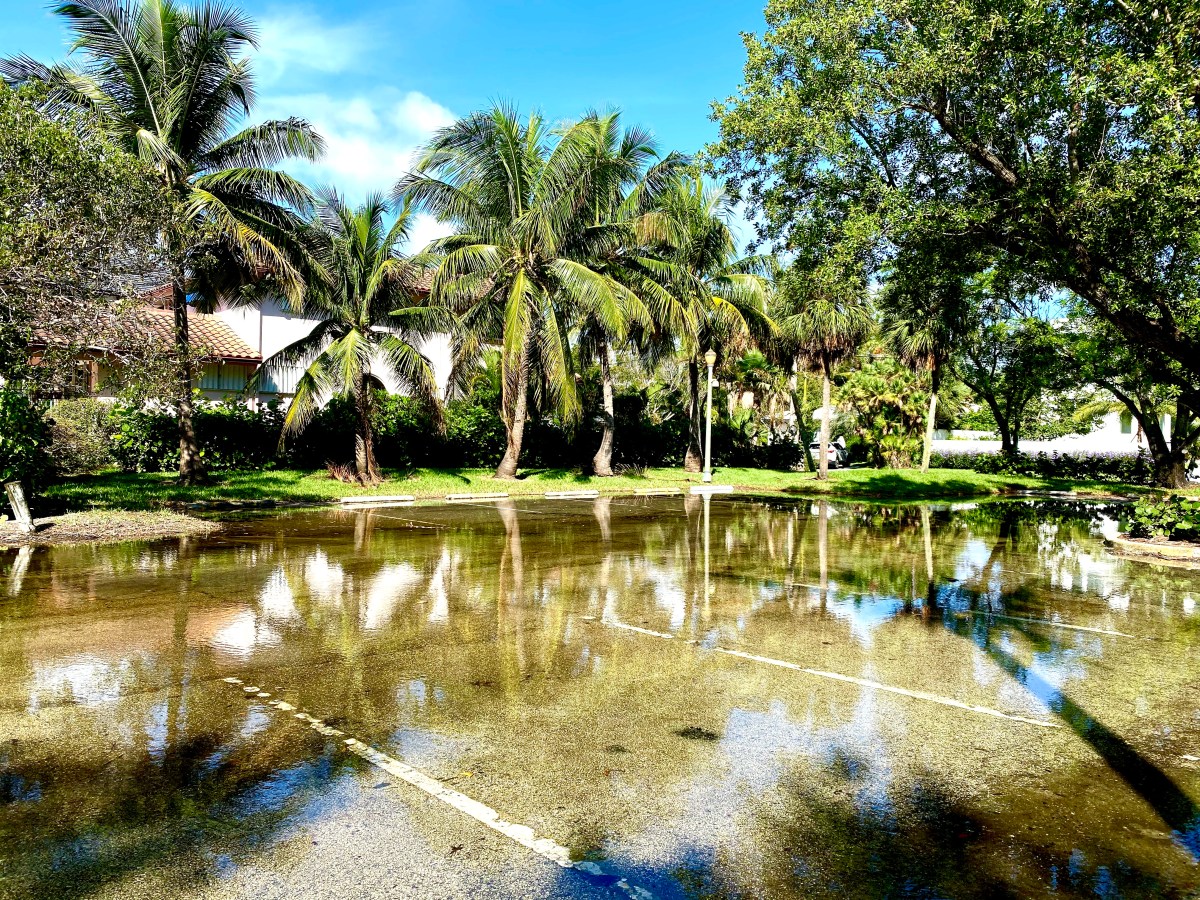
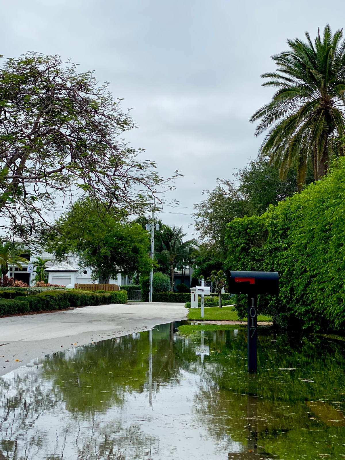
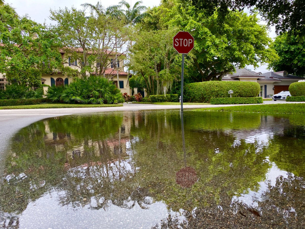
When it comes to identifying localized sea level rise flooding, tidal gauges aren’t necessarily giving the full picture.

Climate researchers published a study this week in the journal Nature Communications that concluded Twitter may provide a more accurate read on what’s actually going on on the ground. Why? For one thing, there are only 132 tidal gauge stations covering over 3,700 miles of the U.S. Gulf of Mexico and Atlantic coastlines. That leaves enormous gaps between the measuring locations.

As a result, the same high tide that causes little or no flooding in a location with a gauge could cause damaging flooding in another location with a different elevation or concentration of people and structures. The study says, “The same degree of inundation could have substantially different social impacts, depending on the distribution of people, infrastructure and economic activity along the coast.”

To get a clearer picture of how the flooding is impacting coastal locations, the researchers studied nearly half a million tweets sent by 5 million Twitter users in about 235 counties. What they found was that nuisance flooding was occurring in many locations that was not detected by tide gauges.

Most of the undetected nuisance flooding occurred in 22 counties, including those that encompass Miami, New York and Boston, with over 13 million people.

Having a clear picture of what’s happening everywhere is critical to drawing up plans to address the sea level rise flooding as the ocean level rises. “Understanding where coastal floods happen, identifying which meteorological and tide conditions produce floods, and grasping the consequences for flood-affected communities and infrastructure is critical for coastal flood preparation and response,” the study said.

Study co-authors, Frances C. Moore, of the Department of Environmental Science and Policy at the University of California, Davis, and Nick Obradovich, of the Max Plank Institute of Human Development in Berlin, Germany, caution that one major limit of their study is that once people get used to the nuisance flooding they become less likely to report it on social media.

The fact that even tidal gauges can’t always be relied on to give the complete picture of sea level rise flooding in a given area is all the more reason that buyers, sellers, owners and real estate agents need to rely on more than one source when considering the flood risk for a given piece of property.

New Report Names Miami the “Most Vulnerable” City in the World for Sea Level Rise Flooding

A new report by Resources for the Future (RFF), a nonpartisan think tank, concludes that Miami will soon become “the most vulnerable major coastal city in the world” for sea level rise flooding, storm surges and other impacts of climate change. The experts based their conclusion on the fact that Miami has billions of dollars worth of real estate and other assets that will be put increasingly at-risk as the seas continue to rise between now 2040.

The RFF published a graphic-rich report titled “Understanding Sea Level Rise in Florida, 2040” last week that illustrates the challenges faced by Miami and the entire state of Florida. The report was created using data collected by the Climate Impact Lab, a group of scientists, economists and other experts who are trying to quantify the impact climate change will have on the world economy in real numbers.

In a press release, the RFF listed the following potential impacts on Florida if the world doesn’t reduce the greenhouse gas emissions that are driving global warming and sea level rise flooding:

  • Severe “100-year floods” will potentially occur once every few years rather than once a century, endangering about 300,000 homes, 2,500 miles of roadways, 30 schools, and four hospitals statewide.
  • Rising seas also threaten the 490,000 Floridians who live on land less than 3 feet above the high-water mark, and coastal properties worth an estimated $145 billion in property value. The counties with the largest number of people facing these risks are Miami-Dade, Broward, Pinellas, Monroe, and Hillsborough.
  • In some areas—the Keys in particular—it is unlikely that communities will be able to meet the costs of raising all public roadways to accommodate higher sea levels by 2045, suggesting that some roads and neighborhoods will need to be abandoned.
  • Miami has over $400 billion in assets put at risk by coastal flooding and storms—the largest amount of any major coastal city in the world.
  • Extreme temperatures and other impacts will seriously affect public health. In a moderate emissions scenario, the rate of mortality is projected to increase by 3.8 deaths per 100,000 Florida residents per year—that’s roughly 1,000 additional deaths annually by 2035.
  • Federal carbon pricing policies, which would reduce these risks, are projected to cost less than $1,000 annually for Florida households earning under $99,000 per year, with costs for higher earners reaching as high as $5,000 annually.

The study’s co-authors said: “Addressing climate change has up-front costs. But failing to address climate change? Those costs are likely to be much greater and long lasting.”

The RFF research was funded by the VoLo Foundation, a private family foundation established to educate the public to create a sustainable and secure planet for generations to come. 

This report further reinforces the fact that buyers, sellers, owners and real estate agents in coastal areas need to be aware of sea level rise and its impact on a property of interest, neighborhood and community to make informed decisions that will protect their financial futures.

Real Estate Buyers Beware: Sea Level Rise is Accelerating

To protect their investment, real estate buyers in coastal areas need to find out if a property of interest, neighborhood and community are currently experiencing sea level rise flooding. They also need to find out if and when sea level rise flooding will impact the property in the future.

The last point is difficult because sea level rise projections are constantly changing. Unfortunately, for most locations the change is usually for the worse. For example, a report released January 30 by William & Mary’s Virginia Institute of Marine Science (VIMS) concluded that the rate of sea level rise is accelerating at most locations along the U.S. coastline.

The scientists studied tide gauge data from 32 locations collected over the last 51 years to reach their conclusion. “Acceleration can be a game changer in terms of impacts and planning, so we really need to pay heed to these patterns,” said VIMS emeritus professor John Boon.

VIMS Marine Scientist Molly Mitchell said, “We have increasing evidence from the tide gauge records that these higher sea-level curves need to be seriously considered in resilience planning efforts.”

When evaluating a piece of property, buyers need to consider how likely it is that sea level rise flooding will impact the property and when it could occur. This is a complicated issue that requires an understanding not only of the flooding risk but what the individual property owner and community can potentially do to prevent the flooding. Another consideration for buyers is how the flooding will impact their property value, maintenance costs, flood insurance premiums and taxes. These issues are discussed in detail in “7 Sea Level Rise Real Estate Questions for Buyers, Sellers, Owners, & Real Estate Agents.”

Can the Florida Keys Afford a Building Boom when They’re Searching for Ways to Retreat from Sea Level Rise Flooding?

Just when a law that’s been on the books since the early 1970s intended to prevent over-development in the Florida Keys is about to prevent new building projects, a state legislator is proposing legislation that could result in a building boom.

According to a Miami Herald article, Representative Rob Rommel, R-Naples, filed an amendment that would increase the hurricane evacuation time for the Keys to 30 hours from the current 24. Under the existing law, the evacuation time limit actually works as a cap on the number of buildings that can be constructed in the Keys. The expectation was that the Keys would be totally built-out by 2023.

According to the article, the new legislation is meant to stave off potentially billions of dollars worth of legal costs if property owners frustrated that they won’t be able to develop their real estate holdings sue the state and county governments for fair compensation.

If the longer evacuation time is approved, officials in the Keys worry that it could result in a building boom that would in turn make it harder for people to evacuate the Keys ahead of a hurricane and make it much more difficult to deal with sea level rise flooding.

County officials in the Keys made headlines last fall when they said sea level rise flooding may force them to abandon roads that are under water for much of the fall king tide season. The problem is so bad that officials there plan to use $20 million in federal funds to buy out and destroy homes wrecked by Hurricane Irma that are vulnerable to sea level rise flooding.

If the Florida state government clears the way for a building boom in the Keys, buyers will have to perform due diligence to ensure the property they intend to purchase isn’t at risk of sea level rise flooding.

Texas, Louisiana and South Carolina Prepare for Climate Change and Sea Level Rise without Using the Terms

The more you study climate change and sea level rise, the more you realize that they’re political issues as well as practical, environmental threats. This point was hit home yet again in a New York Times report that found several conservative states at great risk from rising seas applied for federal funding to increase their defenses against flooding without actually using the terms “climate change” or “sea level rise.”

Texas produced a 306 page application for a share of $16 billion Congress set aside in 2018 to help states deal with climate change impacts without a single mention of climate change or sea level rise. South Carolina didn’t use the terms in its application, while Louisiana didn’t mention “climate change” until the last page of its proposal.

While it’s commendable that the states are actually taking steps to prepare for more intense heat and flooding due to global warming (another divisive term, I know), their reluctance to be frank about the issue and use the terms “climate change” and “sea level rise flooding”, are a tad cowardly. The public in their states deserve the truth, even if they’ve been conditioned to deny it. Real leaders would give them the education about climate change that they clearly need to make informed decisions that just might help them to participate in the process of finding solutions and protect their own financial futures.

Ultimately, the absence of the terms “climate change” and “sea level rise” from the funding proposals is a moot point. The atmosphere will continue heating up and the seas will continue to rise and flood valuable real estate regardless of climate change denialists’ inability to utter them.