Powerful New Tool Gives Real Estate Owners, Developers, Planners & Government Officials a Detailed View of the Threats Posed by Sea Level Rise

One of the greatest challenges for coastal real estate owners, developers, planners and government officials is acquiring a detailed understanding of the complicated challenges sea level rise flooding poses to their communities.

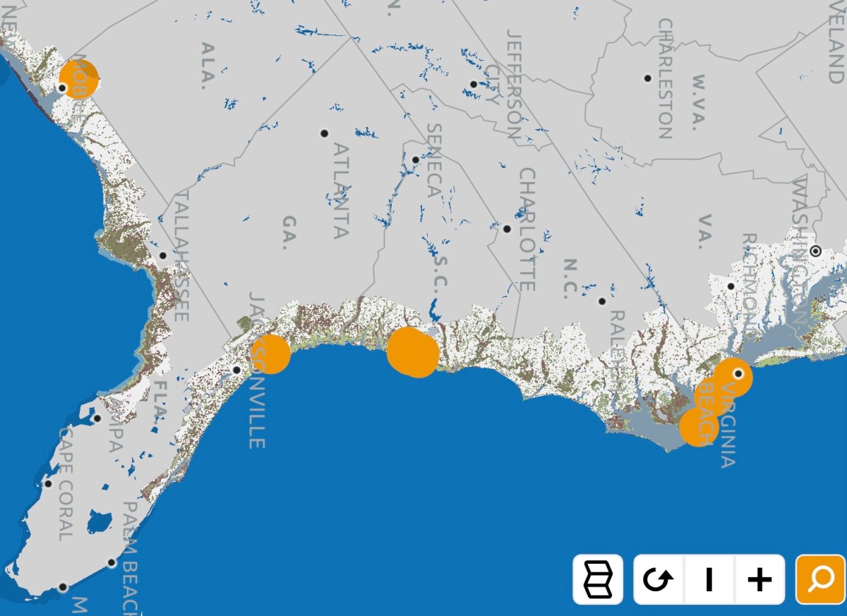
A new tool introduced today by the Southern Environmental Law Center (SELC), a non-profit and non-partisan organization dedicated to defending the environment, aims to deliver a clear view of the threats sea level rise poses to coastal communities in the Southeast through the use of an interactive mapping tool. “The project’s goal is to show citizens and decision-makers how the coast is changing,” the SELC said in a news release, “and how proposed infrastructure projects like highways, neighborhoods, and government or industrial facilities will fare as the water keeps rising and floods get worse.”

Visitors to The Changing Coast website will find an interactive map with overlays that enable them to visualize: 1. The flooding that will occur in their community as sea level rises; 2. Development projects that will be impacted by higher seas; 3. The locations of toxic Superfund sites that could contaminate neighborhoods and water supplies if they’re flooded by ocean water; 4. The locations of socially vulnerable populations who are most at-risk from sea level rise flooding and storm surges; 5. Wetland areas and floodplains that need to be protected from development to act as sea level rise floodwater buffer zones; and 6. Areas that are most at-risk from more powerful storm surges resulting global-warming-fueled stronger hurricanes and tropical storms.

Among the real-world examples of areas where the interactive mapping tool could assist real estate owners, government officials, planners and developers in coastal communities, the SELC offered the following:

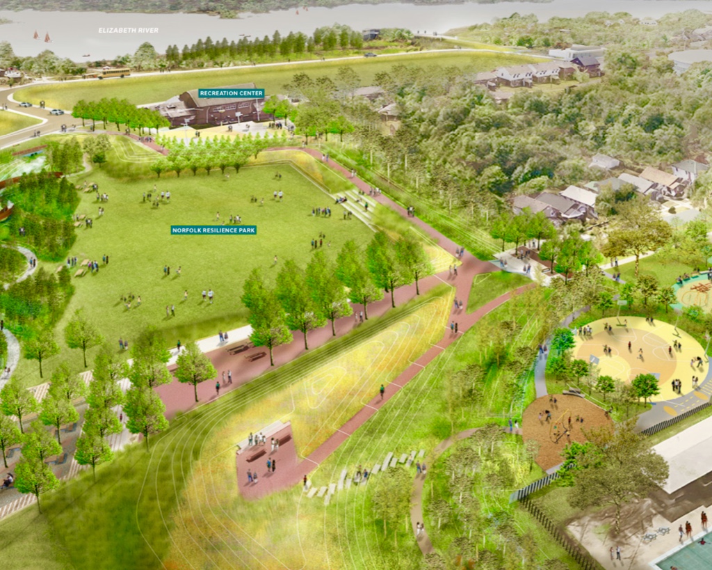
  • “A proposed 9,000-acre housing development in Charleston could flood now with just a Category 1 hurricane. And rising seas could put parts of the development under water before the mortgages are paid off.”
  • “The roads leading to the proposed Mid-Currituck Bridge in North Carolina could be flooded on sunny days in the future if sea level climbs just two feet, rendering the span useless.”
  • “A 21-million-ton pile of toxic coal ash on the banks of the Mobile River in Alabama could likewise be threatened by a Category 2 hurricane, and that threat only increases as sea levels continue to rise. A breach could spread toxic ash into the river, through the Tensaw Delta, and into Mobile Bay.”

“The goal is to help guide decisions for the future, and to plan smart strategies to protect what exists now,” said Chris DeScherer, and SELC senior attorney.

The SELC’s interactive map is a valuable source of information that real estate owners, buyers and agents in the Southeast should use when considering property in coastal communities currently experiencing sea level rise flooding or at-risk of experiencing it in the near future. It would be wonderful if this powerful tool became available in other parts of the country.

The Destructive Relationship Between Sea Level Rise and New Coastal Real Estate Development

Living in a coastal community that’s experiencing sea level rise flooding, I’m amazed at the hundreds of millions of dollars of new commercial and residential real estate being built in neighborhoods that are flooding today or that will soon be subject to floodwaters as the seas continue to rise.

When I ask my real estate agent friends what they think about the situation, they are always quick to remind me that Florida’s economy is heavily reliant on new building projects and the jobs, investment and tax dollars they bring for its very survival.

Many cities and towns along he Atlantic, Pacific and Gulf of Mexico coastlines are equally addicted to new development to keep their economies rolling and their governments solvent. There is, however, clearly a downside to this relationship.

As sea levels continue to rise, those same coastal cities and towns are going to have to start to invest heavily in flood mitigation strategies, such as raising roads and water and sewer pipes, building or raising sea walls and installing pumps. In some cases, they may even have to buy-out homes and whole neighborhoods that flood repeatedly. When this day arrives — and it has already arrived in parts of the Florida Keys and other vulnerable locations — what seemed like a good idea today — allowing hundreds of millions of dollars in new development in areas vulnerable to sea level rise — will have enormous costs to taxpayers and property owners.

Taxpayers will have to pay the tab to protect the expensive new flood mitigation projects. And the higher taxes to pay for those projects, combined with the higher insurance premiums that go hand-in-hand with sea level rise flooding, could cause property values to plummet.

Linda Shi, an assistant professor in Cornell University’s department of city and regional planning, wrote an op-ed titled “The fiscal challenges of climate change” for the Boston Globe. In it, she explains the challenge posed by new coastal development in the age of rising seas. She studied the Massachusetts coastline in detail and discovered:”Statewide, 40 percent of local revenues come from property taxes; along the coast, 60 percent; and in some coastal suburbs, 70-80 percent. State expectations that local governments self-finance most of the services they provide inevitably incentivize continued development wherever possible, placing coastal sites and cities on a collision path with rising seas.”

Shi says the negative cycles could be reversed if cities and states included fiscal considerations into sea level rise flooding vulnerability assessments. She also said regional land-use planning agencies and non-governmental organizations could help by evaluating “how climate change affects local budgets, how fiscal vulnerability and adaptation choices impact the region and vice versa.” Their input would help communities to decide where to allow new real estate developments to minimize the eventual costs that arise due to sea level rise flooding.

The future costs of placing new developments in or near sea level rise flood zones is an important issue to consider today. Making informed decisions will protect subsequent generations from the high cost of protecting or decommissioning billions of dollars worth of real estate our generation knew was at-risk before ground-breaking shovels were turned.

Norfolk Neighborhood Breaks Ground on Sea Level Rise Diversion Project

When confronted by sea level rise flooding, neighborhoods have a choice: Try to hold the waters back, move out of the area, or divert the water into areas designed to accommodate floodwaters.

Virginia Gov. Ralph Northam, Norfolk Mayor Kenneth Alexander and community leaders recently broke ground on a project that takes the last approach to cope with sea level rise flooding. Resilience Park, part of the Ohio Creek Watershed Project, will create a green space to store and absorb floodwater. The project also includes a coastal flood berm, restored tidal creek wetland, and sports and recreational facilities.

A major plus to residents is that that project also includes a walking path that will connect two predominantly African American neighborhoods. “The Ohio Creek Watershed Project is an example of the kind of work we need to do to protect lives, property, and economic opportunity in Hampton roads, and the innovation that will help us build a safer, more sustainable, and resilient Virginia for future generations,” Gov. Northam said.

Virginia is using $112 million of a $120 million U.S. Department of Housing and Urban Development grant to fund the project.

Can the Florida Keys Afford a Building Boom when They’re Searching for Ways to Retreat from Sea Level Rise Flooding?

Just when a law that’s been on the books since the early 1970s intended to prevent over-development in the Florida Keys is about to prevent new building projects, a state legislator is proposing legislation that could result in a building boom.

According to a Miami Herald article, Representative Rob Rommel, R-Naples, filed an amendment that would increase the hurricane evacuation time for the Keys to 30 hours from the current 24. Under the existing law, the evacuation time limit actually works as a cap on the number of buildings that can be constructed in the Keys. The expectation was that the Keys would be totally built-out by 2023.

According to the article, the new legislation is meant to stave off potentially billions of dollars worth of legal costs if property owners frustrated that they won’t be able to develop their real estate holdings sue the state and county governments for fair compensation.

If the longer evacuation time is approved, officials in the Keys worry that it could result in a building boom that would in turn make it harder for people to evacuate the Keys ahead of a hurricane and make it much more difficult to deal with sea level rise flooding.

County officials in the Keys made headlines last fall when they said sea level rise flooding may force them to abandon roads that are under water for much of the fall king tide season. The problem is so bad that officials there plan to use $20 million in federal funds to buy out and destroy homes wrecked by Hurricane Irma that are vulnerable to sea level rise flooding.

If the Florida state government clears the way for a building boom in the Keys, buyers will have to perform due diligence to ensure the property they intend to purchase isn’t at risk of sea level rise flooding.

%d bloggers like this: