Sea Level Rise Poses Challenges for Commercial Real Estate

Residential real estate isn’t the only sector facing challenges from the threats posed by climate change and sea level rise flooding. Commercial real estate is under pressure, too.

According to a report recently released by Dechert LLP, a global law firm that advises corporations, financial institutions, sovereign states and wealthy individuals, “Climate change is forcing the commercial real estate industry to re-think the effectiveness of flood insurance that developers, lenders and investors have relied on for decades.”

The report notes that extreme weather and sea level rise flooding are pushing the commercial flood insurance system “to a breaking point.” Specifically, the report notes that 14 weather and climate disasters in the United States resulted in $91 billion in damages. Each event had losses exceeding $1 billion mostly from damage to residential and commercial real estate.

Among the challenges faced by the commercial real estate sector discussed in the report:

1) The National Flood Insurance Program (NFIP) administered by Federal Emergency Management Agency is financially unstable. The program is now running over $20 billion in the red, and it relies on government bailouts to continue to operate. Its authority to operate is due for renewal next fall. If it’s not renewed the report says, “The potential for disruption is most concerning for property owners in special flood hazard areas seeking mortgages from federally-backed entities and federally regulated banks because flood insurance is legally required for these loans.”

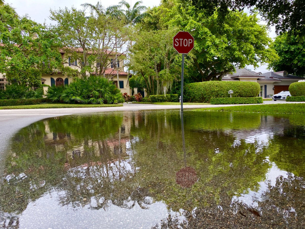
2) FEMA’s flood maps, which are supposed to identify a commercial property’s exposure to flood risk, are notoriously outdated and they do not consider sea level change or increased flooding estimates. “This has led to costly and catastrophic errors,” the report says. “For example, in 2018, at least 140 Florida homes were demolished following the destruction of Hurricane Michael. However, the relevant FEMA flood map reflected that the properties were in flood zone X (0.2% chance of flood in any year) and flood insurance was not required.”

3. Flood insurance only covers damages, not loss of value. The report says this is a problem because as properties become increasingly vulnerable to flooding, the will inevitably lose value over time. “The worst-case scenario here is particularly bleak,” the report says. “Billions of dollars of real estate will be underwater not only in terms of their market value being less than the outstanding mortgage debt, but also because these properties will be at greater risk of someday being literally underwater. Refinancing these mortgages and insuring these properties will undoubtedly become more challenging each passing year.”

The report goes on to explain how uncertainty in the flood insurance market is leaving the the commercial real estate finance industry without a “uniform strategy to underwrite the increased frequency and severity of flooding due to climate change.” The report says the public and private flood insurance industry “will soon be forced to adjust to face the environmental and economic realities of a country more prone to frequent, catastrophic and repeated flooding.”

The authors predict that the commercial real estate finance industry will evolve to meet the challenges to the marketplace. They identified several issues that need to be monitored: “Among the questions are whether the National Flood Insurance Program will be reformed, whether private flood insurers raise their rates to levels only wealthy real estate sponsors can afford, and whether banks and real estate bond buyers will call for more detailed disclosure to more accurately balance the risk of loss.”

The Dechert LLP report focuses on the commercial real estate industry, but most of its discussions, conclusions and warnings also apply to residential real estate. Buyers, sellers, owners and real estate agents in coastal areas should take the time to read this insightful report to better understand the broader issues that will impact their local real estate markets and property values.

Seizure of Real Estate by Eminent Domain Required in Corps of Engineers’ Draft Proposal for Dealing with Sea Level Rise in the Florida Keys

The Army Corps of Engineers recently presented a draft plan to the Monroe County Commission — which governs the Florida Keys — that would require the county to use eminent domain to force property owners in areas experiencing sea level rise flooding who don’t want to participate in a buyout program to sell their property.

The Corps’ $3 billion plan, intended to help the Keys to deal with sea level rise flooding, includes projects to elevate homes, critical businesses and buildings, like hospitals and fire houses. Where protecting real estate from floodwaters is prohibitively expensive or not technically possible, the Corps is proposing “retreat” — where the properties would be purchased and demolished.

Corps and county officials hope that most property owners would recognize the problem and voluntarily participate in a buyout program. To prevent the creation of neighborhoods with a checkerboard of demolished properties and inhabited homes, the Corps is proposing that the county be required to use eminent domain to force the remaining residents to sell their properties. The concern is that if residents remain in neighborhoods that flood, the government will still have to provide essential services and flood protection, which are the expenses they’re trying to avoid.

Susan Layton, a Corps chief of planning and policy, told the Miami Herald, “We don’t ever go straight to condemnation. We always start with negotiating and coordinating with homeowners and looking for willing sellers.”

Monroe County Officials are nervous about the prospect of eminent domain. County Mayor Heather Carruthers said she’s disturbed by that part of the Corps’ proposal. “I don’t know if we want to have that conversation now, if that’s a nonstarter for us,” she said.

The Corps will seek input from Keys officials and the public before the draft proposal is finalized in September 2021.

Because of their low elevation and exposure to the seawater on all sides, the Keys are at the front lines in the battle against sea level rise. How it adapts to sea level rise flooding will have an enormous impact on planning in the rest of the country. Buyers, sellers, owners and real estate agents in coastal areas should keep informed about what happens there.

California Coastal Commission and Malibu Developer Clash Over Sea Level Rise Height Predictions

The California Coastal Commission, the City of Malibu and coastal developer at clashing over a new beach development on the Pacific Coast Highway. One of the major points of contention is estimates of how much the sea will rise by 2100.

The city approved the developer’s plan based on an old sea level rise estimate of 1.5 feet by the turn of the century. The Coastal Commission takes issue with that prediction, which it says will put the property at a greater risk of flooding.

An engineer the city used to evaluate the project approved the 1.5 foot estimate because that was the number the Coastal Commission included in its 2015 guidance document. The Coastal Commission says the engineer should have used its region-specific estimate and updated 2018 guidance.

The gap between the Coastal Commission and the engineer is enormous. The sea level rise estimate was increased to over five feet in 2018. According to an article in the Malibu Times, a Coastal Commission staff report said, “The difference is more than 4.65 feet, which is significant in determining the required setback, finished floor elevation, and safety of the proposed structure from extreme events and sea level rise.” The report also mentions that scientists are now estimating that the seas could rise anywhere from 3.3 feet to 10 feet by the end of the century.

Scientists are having a tough time predicting sea level rise precisely because humans continue to burn the fossil fuels that create the greenhouse gases that are causing global warming at an accelerated rate. If society continues on this track, even the most liberal predictions could turn out to be conservative, especially if the Greenland and Antarctic ice sheets melt faster and are destabilized to the point where land-based glaciers flow more rapidly into the sea.

The Malibu case is just one example where real estate developers and cities are relying on the most optimistic sea level rise estimates for new construction projects. Buyers shouldn’t trust that a developer or city has done its homework when they purchase a coastal property. Independent due diligence is required to make sure they’re fully informed regarding the risk of sea level rise flooding in the years to come.

Boston Mounts an Aggressive Plan to Battle Sea Level Rise Flooding

Much of Boston, MA, is built on landfill, which makes it especially vulnerable to sea level rise flooding. With estimates ranging anywhere from 10 inches of global sea level rise to over seven feet by the end of this century, the city is mounting an aggressive plan to hold back the rising seas, according to a Washington Post article.

With over nine inches of sea level rise racked up since the beginning of the last century, areas of Boston are already experiencing sea level rise flooding that’s especially noticeable during extra high king tides in the fall.

To fight back against sea level rise flooding and the higher than normal storm surges it can bring, the Boston’s mayor is dedicating more than $30 million a year to address the problem. Among the projects are elevating streets and parks, and building higher berms and sea walls. City officials are concerned that they’re not doing enough to protect residents and real estate in the poorest neighborhoods, but they are considering options.

Despite the effort to combat sea level rise, Michael Oppenheimer, a professor of geosciences and international affairs at Princeton University, told the Post, Boston and other coastal cities may still ultimately have to retreat from the rising seas. He said, “It is what a lot of cities will have to do because a lot of neighborhoods are not defensible.”

Boston’s experience with sea level rise flooding as discussed in this article is yet another example of why buyers, sellers, owners and real estate agents in coastal areas need to educate themselves on which properties and neighborhoods are experiencing sea level rise flooding and what, if anything, can be done to hold back the rising tides.

Hawaii’s Trying to Decide Where to Allow New Real Estate Developments in Areas Threatened by Sea Level Rise

Lawmakers in Hawaii are taking on an issue few coastal states are ready to address: Where do you allow new real estate developments when scientists are predicting up to three-to-six feet of sea level rise by the end of this century?

The answer could have a huge impact on real estate developers, builders and people seeking affordable housing.

According to a report on Honolulu Civil Beat, some legislators in Hawaii are promoting a bill that would prevent new construction in areas below 6 1/2 feet of the current sea level. With land elevations varying greatly, that would still allow some construction right on the shore while developers wouldn’t be allowed within a half mile of beaches in other areas. Builders in Honolulu say that limit would prevent them from constructing many new developments, including projects that would be sold at a more affordable price point.

The stakes are high for Hawaii. Scientists predict that even 3.2 feet of sea level rise by 2100 would displace more than 13,000 people and lead to $12.9 billion in economic losses in Oahu alone.

As in other states, there are areas in Hawaii where coastal real estate is already experiencing flooding due to rising seas. Finding solutions that serve the needs of current generations while looking out for the future is a difficult political tightrope to walk. Further complicating the issue is the fact that the burning of fossil fuels, global warming, and rising sea levels are continuing at an accelerating pace, which makes it difficult to issue the accurate predictions coastal communities need for planning purposes.

That Hawaii is discussing this difficult issue is commendable. Other states need to step up to the plate to protect people and property.

South Carolina Latest State to Consider Hiring a Sea Level Rise Resiliency Chief

South Carolina Governor Henry McMaster has proposed the creation of a chief resiliency office position at the highest levels of state government to help coordinate the state’s response to extreme storms and sea level rise flooding.

According to a report in The Post and Courier, the resiliency chief would develop plans to seek federal funding for flood mitigation projects, control development in vulnerable areas, and improve how the state responds to disasters.

If the new position is approved, South Carolina would join Florida and North Carolina — states long considered resistant to discussing climate change and sea level rise flooding — in appointing a high level official to deal with the problems created by global warming.

The South Carolina climate change czar would also be responsible for collecting the latest climate change information and relaying it to government officials and the public. Local government officials have told the state they need money for seawalls, drainage improvements and other projects to hold back rising tides. Charleston alone estimates it needs $2 billion to protect residents and real estate.

It’s unclear at this point whether Gov. McMaster’s proposal will get the support it needs from the state legislature. Meanwhile, sea level continues to rise.

Record Temperatures in Antarctica May Signal More Rapid Sea Level Rise

A weather station in Antarctica recorded the hottest temperature ever reached on Earth’s southern-most continent. Scientists at Argentina’s Esperanza research station on the Antarctic Peninsula said the temperature hit 65 degrees Fahrenheit.

Randall Cerveny, an official with the World Meteorological Organization, told National Public Radio, “This is unfortunately a continuing trend.” The station set the just-broken heat record in 2015. Cerveny added, “We are seeing these high temperature records — not only in Antarctica, but across the entire world — fall, whereas we just don’t see cold temperature records anymore.”

The last decade was the hottest ever recorded. Researchers are concerned that this is setting up a positive feedback loop where the warmer weather warms seawater which melts glaciers which causes even more warming. The end result is that the seas rise at an ever quickening pace, which puts more coastal areas at risk of flooding.

Melting glaciers in Antarctica and Greenland are the greatest contributors to sea level rise. Scientists worry that instability in the ice sheets due to global warming could lead to a massive release of ice and meltwater into the oceans. They’re working to understand the many ways warm air and seawater are impacting the glaciers. Their findings will help buyers and owners to decide where it’s safe to invest in coastal real estate.

Scientists Identify the Greatest Obstacle to Educating Real Estate Owners about the Threat of Sea Level Rise Flooding

Social scientists studying the effectiveness of climate change communications strategies wrote an opinion piece that concluded personal financial interest is the leading cause of real estate owners in coastal areas denying that sea level rise flooding poses a threat to their property.

Risa Palm, a professor of Urban Studies and Public Health at Georgia State University, and Toby W. Bolsen, an associate professor of American politics in the political science department at Georgia State, wrote the column for The Conversation. They said they showed property owners who lived in South Florida neighborhoods at-risk of sea level rise flooding and hurricane storm surge maps produced by First Street Foundation that indicated that their properties could be inundated or be impacted in other ways by floodwaters in the next 15 years. Their homes were also identified as being at risk of devaluation due to their proximity to the threat of sea level rise flooding.

“Surprisingly, we found that those who had viewed the maps were on average, less likely to say they believed that climate change was taking place than those who had not seen the maps,” Palm and Bolsen wrote. “Further, those who saw the maps were less likely than those survey respondents who had not seen the maps to believe that climate change was responsible for the increased intensity of storms.”

The researchers said Republicans surveyed “had the strongest negative response to the maps.” In fact, they found “party identification was the strongest predictor of general perceptions of climate change and sea level rise.” Ultimately, however, they said, “the majority of homeowners denied that there was a risk to their property values, regardless of political affiliation.”

In the end, Palm and Bolsen recommended that governments and organizations trying to educate the public about the threat of sea level rise flooding not only use easy to understand facts but a “nuanced approach” to change the way the information is perceived. Or, as they said, “As advertisers well know, it takes more than facts to sell any product.” To get people to stop and pay attention, the information also needs “an emotional hook.”

This study may explain why buyers continue to purchase property and owners continue to hold real estate that scientists have clearly identified as at-risk of sea level rise flooding within the next couple of decades. Unfortunately, turning a blind eye to this factual information won’t save them as the seas continue to rise at an ever-quickening pace.

Twitter Helps Researchers Identify Localized Sea Level Rise Flooding

When it comes to identifying localized sea level rise flooding, tidal gauges aren’t necessarily giving the full picture.

Climate researchers published a study this week in the journal Nature Communications that concluded Twitter may provide a more accurate read on what’s actually going on on the ground. Why? For one thing, there are only 132 tidal gauge stations covering over 3,700 miles of the U.S. Gulf of Mexico and Atlantic coastlines. That leaves enormous gaps between the measuring locations.

As a result, the same high tide that causes little or no flooding in a location with a gauge could cause damaging flooding in another location with a different elevation or concentration of people and structures. The study says, “The same degree of inundation could have substantially different social impacts, depending on the distribution of people, infrastructure and economic activity along the coast.”

To get a clearer picture of how the flooding is impacting coastal locations, the researchers studied nearly half a million tweets sent by 5 million Twitter users in about 235 counties. What they found was that nuisance flooding was occurring in many locations that was not detected by tide gauges.

Most of the undetected nuisance flooding occurred in 22 counties, including those that encompass Miami, New York and Boston, with over 13 million people.

Having a clear picture of what’s happening everywhere is critical to drawing up plans to address the sea level rise flooding as the ocean level rises. “Understanding where coastal floods happen, identifying which meteorological and tide conditions produce floods, and grasping the consequences for flood-affected communities and infrastructure is critical for coastal flood preparation and response,” the study said.

Study co-authors, Frances C. Moore, of the Department of Environmental Science and Policy at the University of California, Davis, and Nick Obradovich, of the Max Plank Institute of Human Development in Berlin, Germany, caution that one major limit of their study is that once people get used to the nuisance flooding they become less likely to report it on social media.

The fact that even tidal gauges can’t always be relied on to give the complete picture of sea level rise flooding in a given area is all the more reason that buyers, sellers, owners and real estate agents need to rely on more than one source when considering the flood risk for a given piece of property.

New Report Names Miami the “Most Vulnerable” City in the World for Sea Level Rise Flooding

A new report by Resources for the Future (RFF), a nonpartisan think tank, concludes that Miami will soon become “the most vulnerable major coastal city in the world” for sea level rise flooding, storm surges and other impacts of climate change. The experts based their conclusion on the fact that Miami has billions of dollars worth of real estate and other assets that will be put increasingly at-risk as the seas continue to rise between now 2040.

The RFF published a graphic-rich report titled “Understanding Sea Level Rise in Florida, 2040” last week that illustrates the challenges faced by Miami and the entire state of Florida. The report was created using data collected by the Climate Impact Lab, a group of scientists, economists and other experts who are trying to quantify the impact climate change will have on the world economy in real numbers.

In a press release, the RFF listed the following potential impacts on Florida if the world doesn’t reduce the greenhouse gas emissions that are driving global warming and sea level rise flooding:

  • Severe “100-year floods” will potentially occur once every few years rather than once a century, endangering about 300,000 homes, 2,500 miles of roadways, 30 schools, and four hospitals statewide.
  • Rising seas also threaten the 490,000 Floridians who live on land less than 3 feet above the high-water mark, and coastal properties worth an estimated $145 billion in property value. The counties with the largest number of people facing these risks are Miami-Dade, Broward, Pinellas, Monroe, and Hillsborough.
  • In some areas—the Keys in particular—it is unlikely that communities will be able to meet the costs of raising all public roadways to accommodate higher sea levels by 2045, suggesting that some roads and neighborhoods will need to be abandoned.
  • Miami has over $400 billion in assets put at risk by coastal flooding and storms—the largest amount of any major coastal city in the world.
  • Extreme temperatures and other impacts will seriously affect public health. In a moderate emissions scenario, the rate of mortality is projected to increase by 3.8 deaths per 100,000 Florida residents per year—that’s roughly 1,000 additional deaths annually by 2035.
  • Federal carbon pricing policies, which would reduce these risks, are projected to cost less than $1,000 annually for Florida households earning under $99,000 per year, with costs for higher earners reaching as high as $5,000 annually.

The study’s co-authors said: “Addressing climate change has up-front costs. But failing to address climate change? Those costs are likely to be much greater and long lasting.”

The RFF research was funded by the VoLo Foundation, a private family foundation established to educate the public to create a sustainable and secure planet for generations to come. 

This report further reinforces the fact that buyers, sellers, owners and real estate agents in coastal areas need to be aware of sea level rise and its impact on a property of interest, neighborhood and community to make informed decisions that will protect their financial futures.